Field Traffic Model (FiTraM)
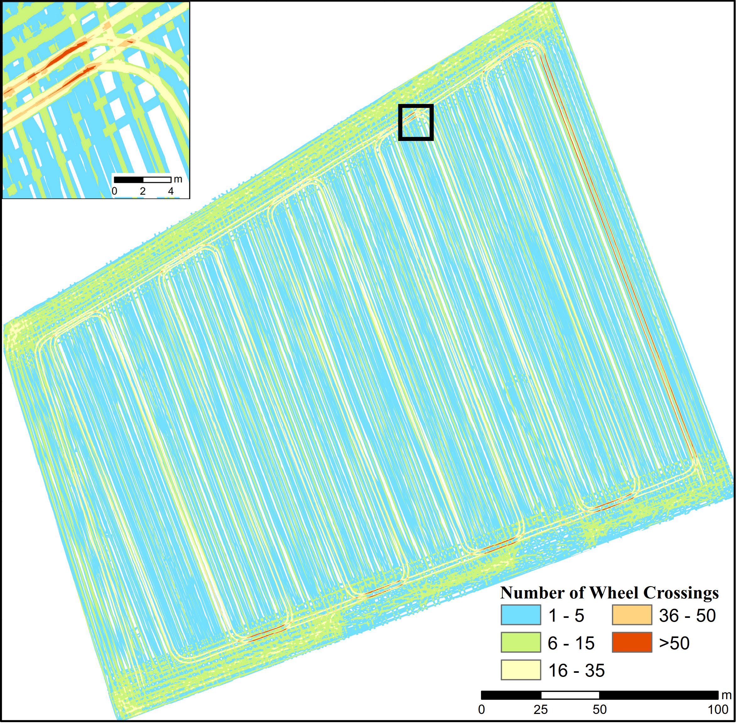
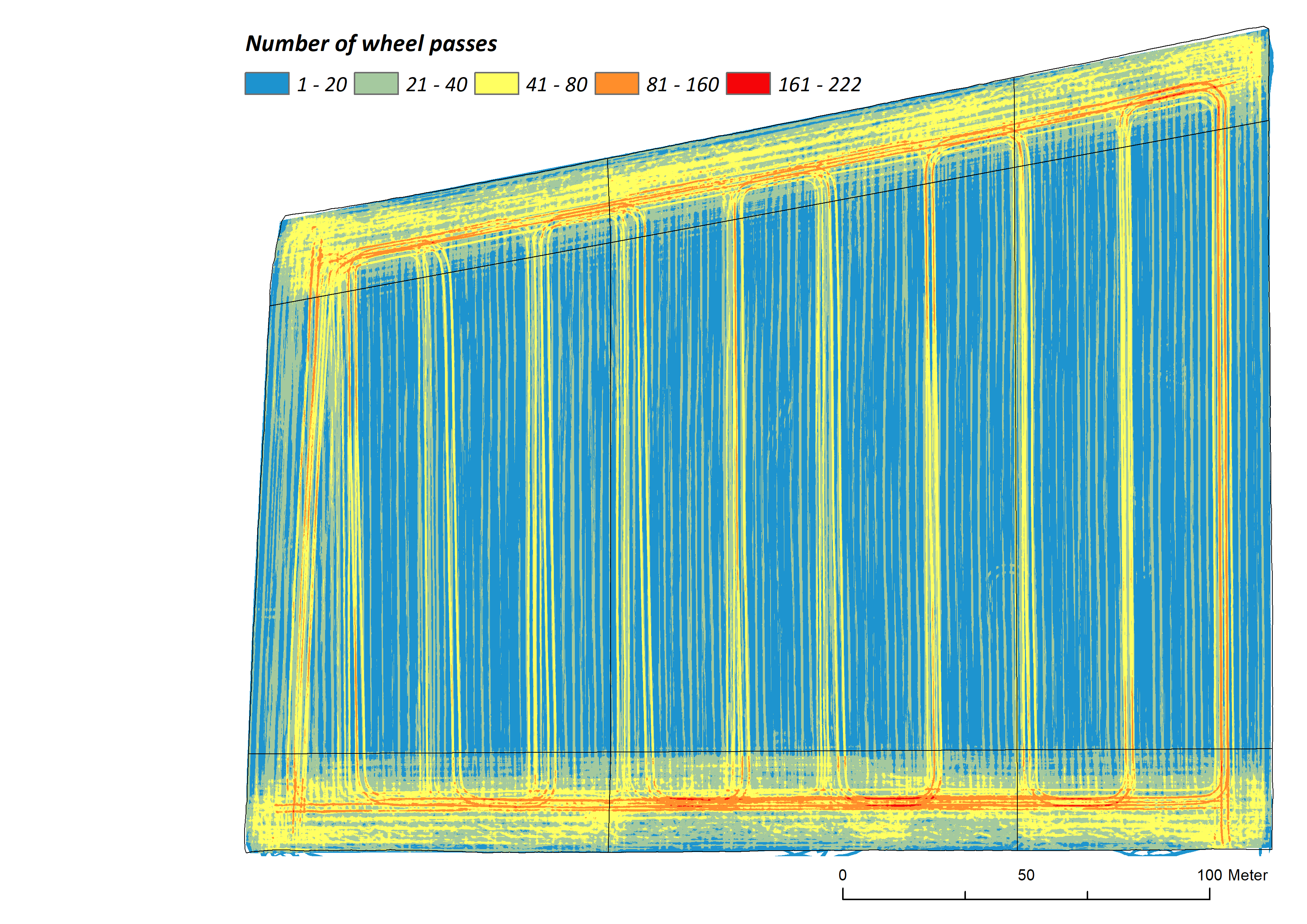
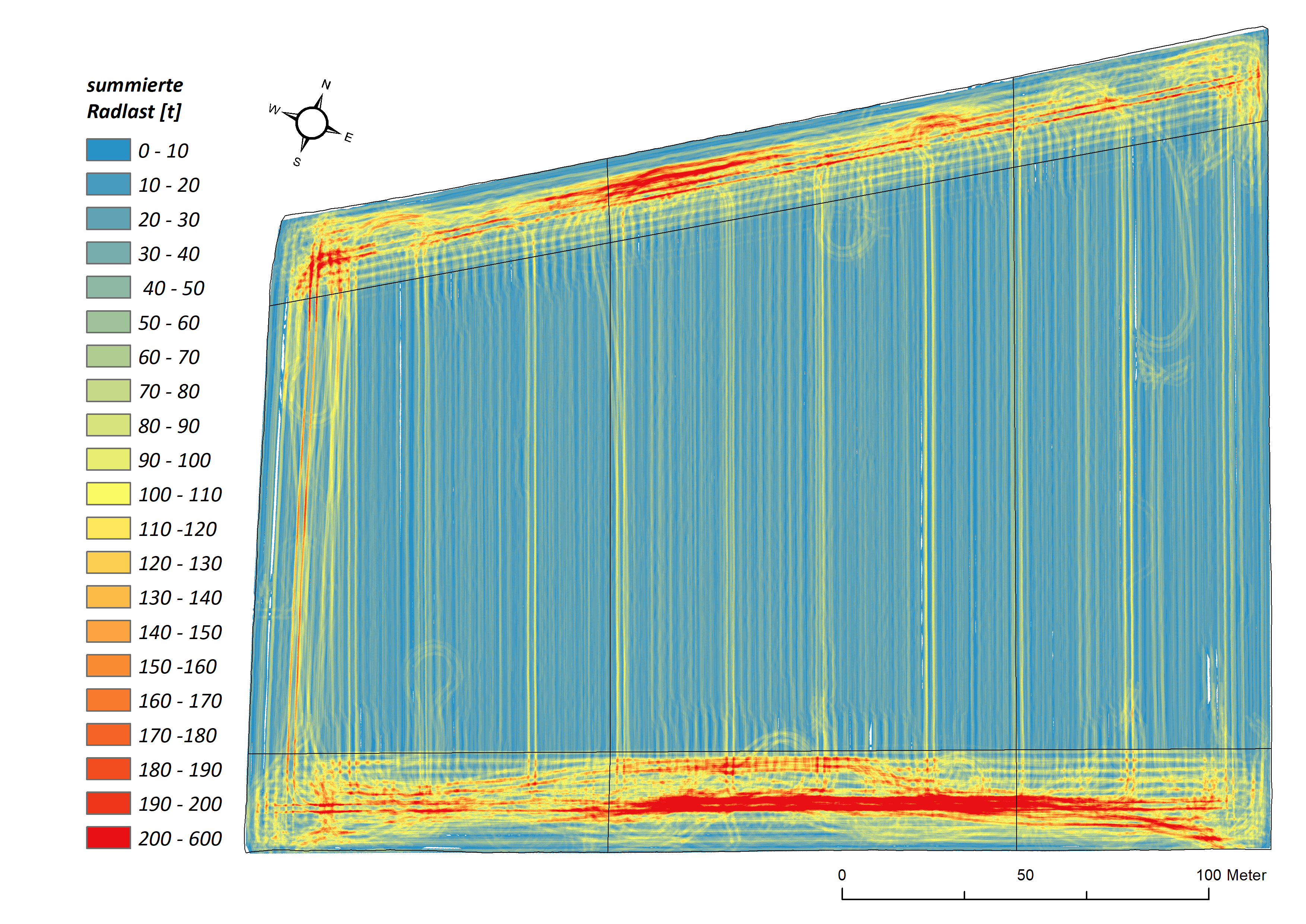
The FiTraM (Field Traffic Model) application models the spatially exact tracks of agricultural machines in the field (Augustin et al. 2019).
For this purpose, the routes of the vehicles during the field survey are recorded with a high-precision RTK-GPS (real time kinematic global positioning system). In combination with the machine characteristics, the wheel tracks for each individual tire are then spatially calculated. From the calculated tracks, the intensity of traffic - number of wheel passes, wheel load, pressure input - can be derived on field scale.
Thus, for the first time, real, spatially highly precise information on the intensity of driving for (i) individual operations and (ii) entire crop rotations can be provided.
Scroll to top